


Wall map of the Republic of Belarus
The general geographic map of the Republic of Belarus provides the most general idea about the territory of our country.
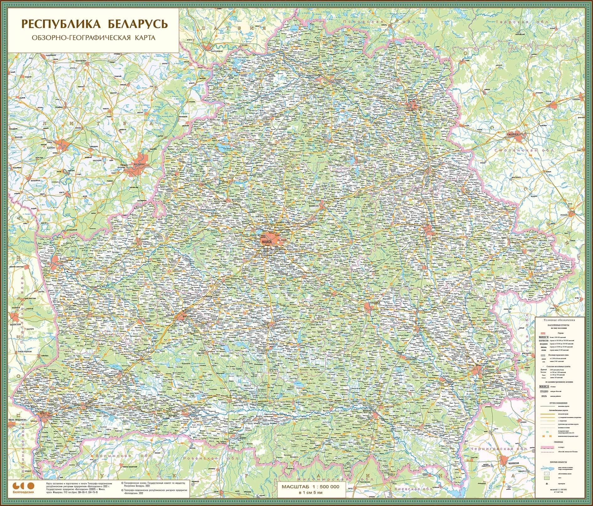
Using this map, you can get reliable and up-to-date information about the natural and socio-economic elements of the area:
● hydrographic system;
● transportation routes - you can see all the major roads and railroads on the map;
● populated areas - the map contains detailed information about the populated areas with their classification by type of settlement, number of inhabitants and administrative significance;
● vegetation cover;
● administrative and territorial structure - the map contains reliable information about the boundaries of the country and regions, gives a clear picture of the country's administrative and territorial structure.
The general geographic map of Belarus was created based on the state topographic maps at a scale of 1:100,000 and 1:500,000, which indicates a high accuracy in representing the objects on the terrain.
The map can be made in several scales.
Tariffs for printing maps of the Republic of Belarus.
Note: cost of lamination is not included in the table.
Edition:
- lotted output;
- available in Russian.
Our advantages:
- constant monitoring of the terrain provides a high degree of information relevance;
- maximum size of the map of the Republic of Belarus is 2171x1921 mm, which ensures better visibility;
- custom sizes and colour solutions are possible,
- we can make a customized map with additional information provided by the customer.
To get a consultation
Chief Expert: Natalya P. Perzashkevich
Mobile: +375 44 771 07 42
E-mail: navigation@belgeodesy.by
Deputy Chief Development Engineer: Evgeniy Vladimirovich Strelchen